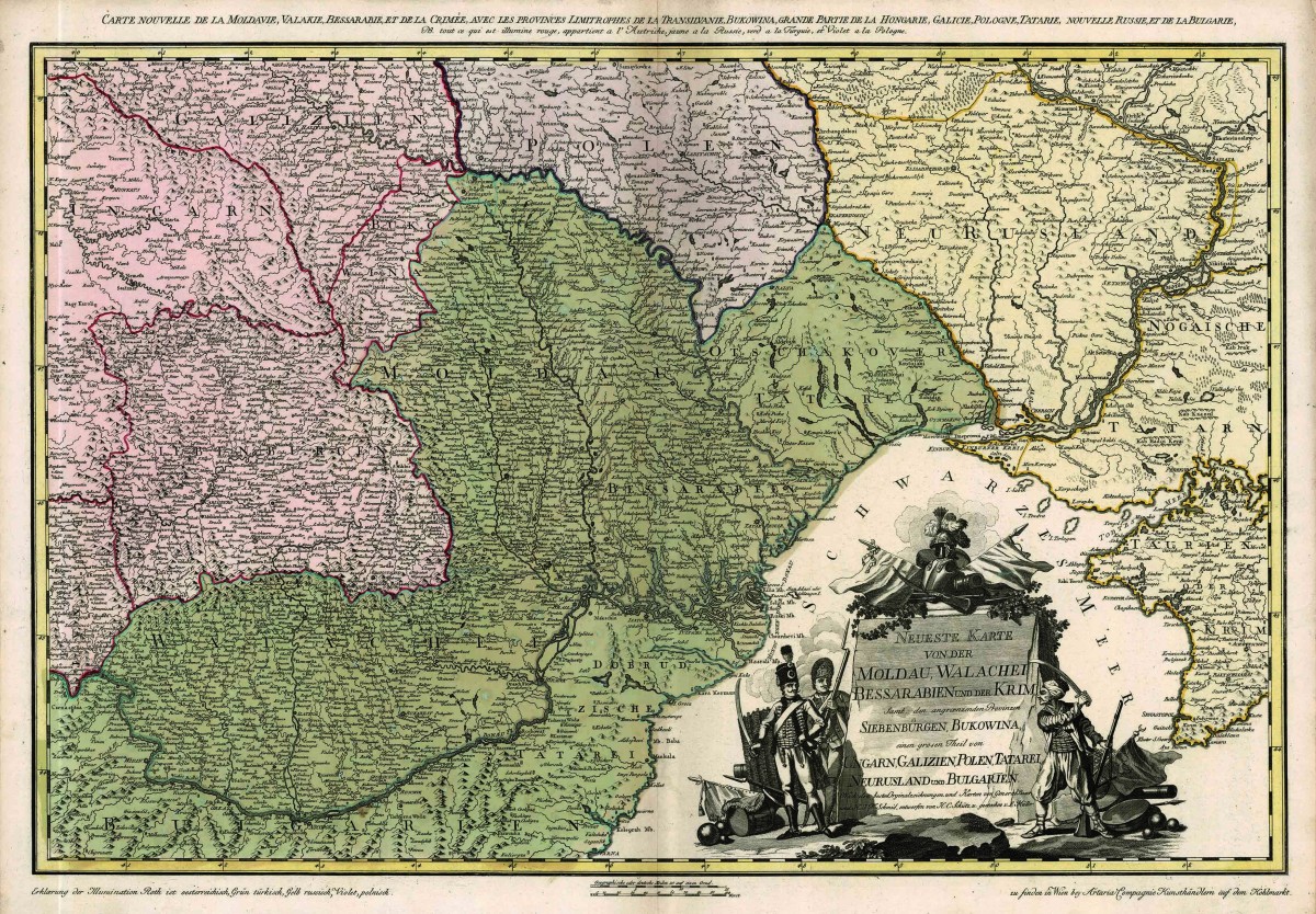
Siebenbürgen mit seinen Nachbarregionen / Transylvania and its neighbouring regions
Car Schütz / Franz Müller, 1788
Kupferdruck / copper plate print
Privatsammlung Dr. Ovidiu Şandor, Temeswar (Kat. 5.13)
Dr. Ovidiu Şandor private collection, Timișoara (cat. 5.13)
Im Mittelpunkt der Karte des russisch-österreichisch-osmanischen Kriegsschauplatzes stehen Siebenbürgen und die beiden Donaufürstentümer. Vor allem die Darstellung der Walachei, Moldau und Bessarabiens profitiert von dem geografischen Wissen, das die russische Militärkartografie hervorgebracht hat. Husar, Infanterist mit Gewehr und Janitschar repräsentieren die wichtigsten Waffengattungen der imperialen Armeen.
The focal point of the map of the Russian-Austrian-Ottoman theatre of war is Transylvania and the two Danube principalities. Above all the representation of Wallachia, Moldavia and Bessarabia profits from the geographical knowledge that Russian military cartography had brought forth. Hussars, infantry fusiliers, and janissaries represent the most important service branches of the Emperor’s armies.
(Object from: Privatsammlung Dr. Ovidiu Şandor, Temeswar (Kat. 5.13) / Dr. Ovidiu Şandor private collection, Timișoara (cat. 5.13))